
The map of the whole island: the five continental nations (Axia, Castalia, Theknus, Iridia and, in the centre, the plateau of Altaluna), the two minor islands (Eos to the north and Alma to the southwest), and the seas and gulfs that separate them.
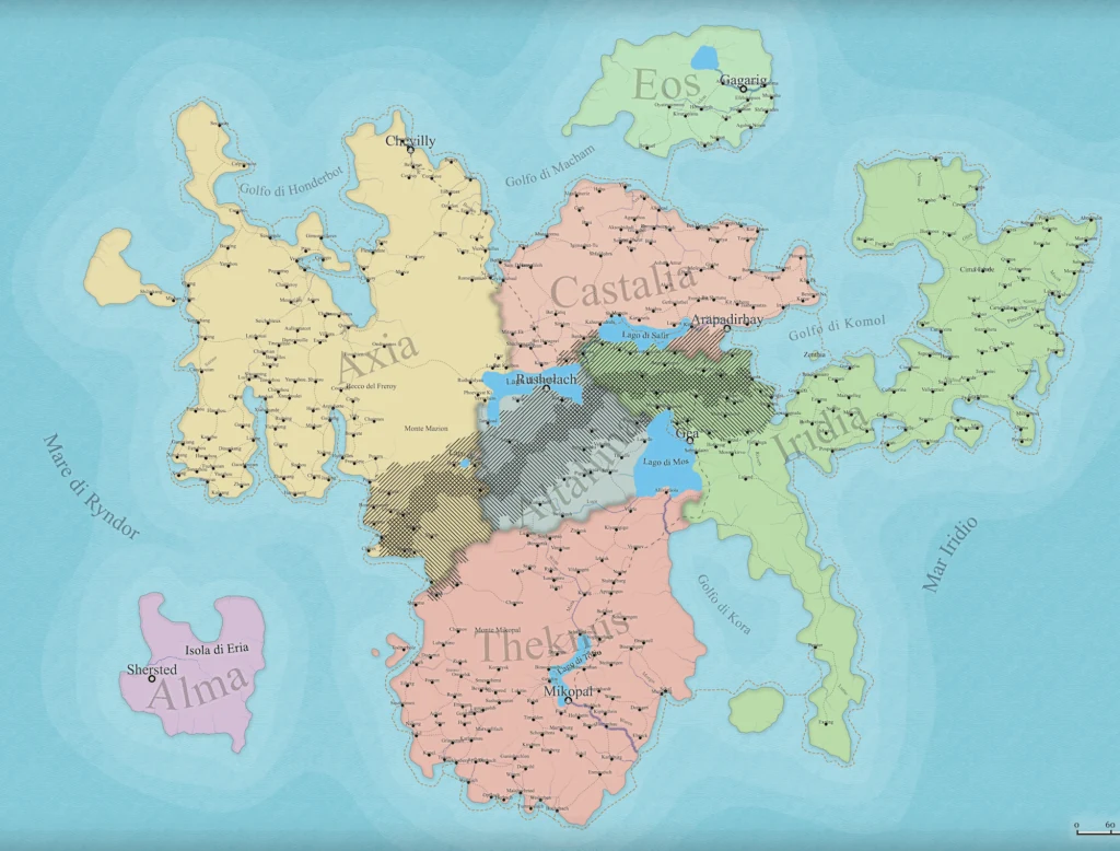
The map of Solaria. Dashed in the middle, the front line of the war: it separates Theknus and Iridia from Axia and Castalia and cuts the plateau of Altaluna in two. To the southwest, in the Sea of Ryndor, the dashed line of the Horizon of the Manifold marks the point where the map stops.
How to read it
- To the west, facing the Sea of Ryndor, lies Axia, the largest nation; to the north Castalia, between the Gulf of Macham and the Gulf of Komol. Together they form the Northern Alliance.
- To the south lies Theknus, with its two capitals, Yantra and Sankofa; to the east, on the Iridian Sea, Iridia. Together they form the Southern League.
- In the centre, where all the meridians meet, the plateau of Altaluna.
- Beyond the Gulf of Macham, to the north, the island of Eos; to the southwest, beyond the Horizon, Alma.
The maps of the single regions, cut out from this one, are gathered on the Maps page and at the top of each nation’s entry. The figures for area and population are in the Demographics of Solaria.